DePIN Scan: Learn about Geodnet
GEODNET – #DePIN Network Improving GPS Accuracy and Reliability at Scale

DePIN is new class of web3 projects building networks to solve real-world problems. One such real-world problem is GPS accuracy and reliability. What is the DePIN project GEODNET all about? GEODNET is an acronym for Global Earth Observation Decentralized Network, and the project is run by veterans in the GPS industry. GEODNET is using token incentives to build the world’s larged Real-Time Kinematic (RTK) reference station network. RTK is an advanced form of GPS that combines normal GPS satellite data with local reference station data to instantly achieve an up to 200x improvement in GPS accuracy.
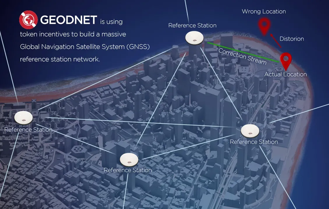
Here’s how it works: Most of the time, your position on the ground as determined by GPS relies on a satellite that is more than 10,000 miles above you. Only after your phone, car, or whatever device receives these faint and distant signals can the GPS estimate where you are. It all works surprisingly well given the distances involved, but the estimated location can still be anywhere from a few to a few dozen meters off. We’ve all seen this happen in our car or on our phone. “You have arrived at your destination” just means you’re pretty close. In order to improve that accuracy, you need a reference station.
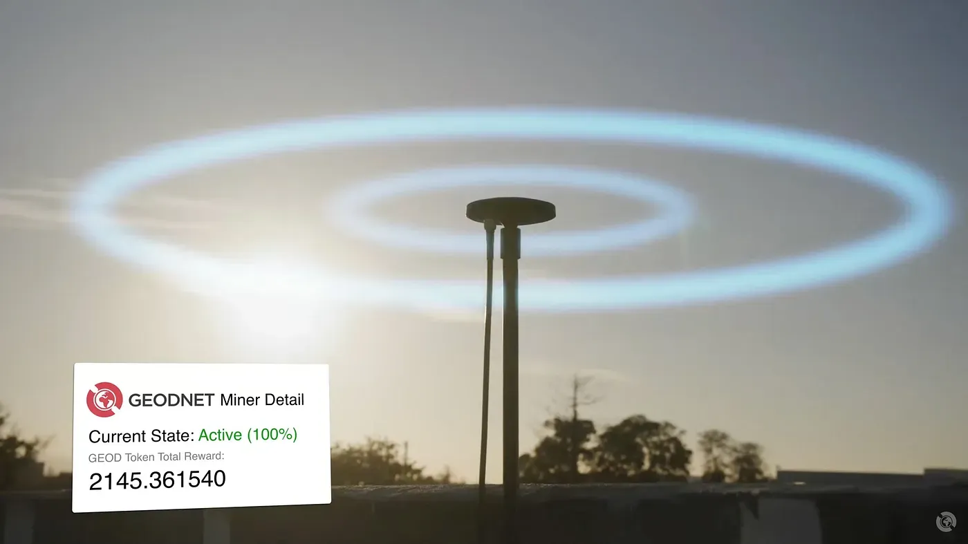
That’s where blockchain and cryptocurrency come in. In order to build the largest RTK station network, GEODNET designed a system where individuals can install a small geodetic-grade GNSS antenna on their roof to provide a node on this network — all over the world. As a reward for providing these reference points, individuals are rewarded in GEOD tokens.
The RTK reference station network issues what’s known as a “correction stream,” and all the devices within about 20 – 40km of a given reference station that are subscribed to receive this correction data can achieve instant centimeter accuracy! This is exactly how Real-Time Kinematic (RTK) works, but GEODNET can provide the service with better coverage and a fraction of the costs normally associated with this service.
Other GNSS signal processing techniques such as Precise Point Positioning (PPP) and PPP-RTK can extend the effective range of the reference station at the tradeoff of reduced convergence speed and some accuracy. These are all supported by GEODNET’s station network as well.
Devices that can take advantage of this accuracy could be your phone in the city (where accuracy is typically strained), or a tractor in a field, or a high-tech land surveying device where a centimeter makes a difference.
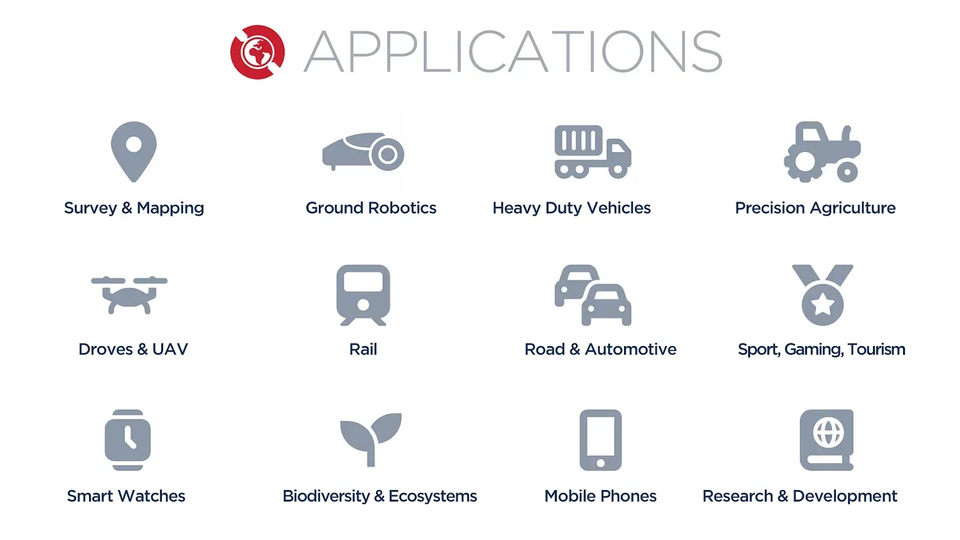
High-precision location enables enterprises increased automation and efficiency in established industries such as Agriculture, Construction, and Transportation. Autonomous vehicles, including drones and self-driving automobiles, depend on high-integrity centimeter accuracy localization to safely operate. Consumer-facing mobile apps will benefit from more reliable and convenient maps. Scientists will use GEODNET stations to study the Earth itself. Early warning of tsunamis, the motion of tectonic plates, and atmospheric changes are all better understood with measurements provided by a dense network of GNSS receivers.
GEODNET is already generating data stream revenues and providing operational benefits to leaders in the GNSS industry including more than a dozen B2B business partners. The service supports virtually every RTK capable receiver in the field via a well-established protocol called NTRIP. Our YouTube channel has several customer related videos from Agriculture, Drones, and Autonomous Vehicles.
DePIN Scan: GEODNET Overview
The GEODNET network is growing rapidly and has over 4700 RTK stations added to the network so far. Anyone with a clear sky view can set up a station and #MineTheSky to earn GEOD tokens. Join us as we revolutionize the GNSS industry.