Latest GEODNET News

a month ago
GEODNET Testifies Before Congress on Decentralized Infrastructure
On April 10, 2025, Mike Horton, the project creator of GEODNET, delivered a significant testimony before the U.S. Congress, representing both GEODNET and the broader Decentralized Physical Infrastructure Networks (DePIN) ecosystem. His presentation highlighted the transformative potential of blockchain-powered DePINs, which are already making strides in providing scalable and cost-effective infrastructure solutions across critical sectors such as internet connectivity, precision navigation, and renewable energy. This testimony marks a pivotal moment in the recognition of decentralized technologies by U.S. policymakers.
The growing acknowledgment from government officials underscores the increasing importance of decentralized technologies in addressing infrastructure challenges. Horton’s testimony not only showcased the achievements of GEODNET but also emphasized the broader implications for the DePIN ecosystem. The ability of these networks to deliver essential services efficiently and sustainably is a testament to the innovative capabilities of blockchain technology, which is gaining traction in various sectors.
This event serves as a proud milestone for those involved in the development of decentralized infrastructure. It acts as a powerful motivator for stakeholders committed to building the future of infrastructure through decentralized solutions. As the momentum behind these technologies continues to build, it is clear that the integration of blockchain into physical infrastructure is set to play a crucial role in shaping a more connected and sustainable future.
a month ago
DroneDeploy Partners with GEODNET for Enhanced RTK Network Access
DroneDeploy, a leading company in aerial and ground reality capture, has announced a strategic partnership with the GEODNET Foundation, which operates a global real-time kinematics (RTK) network. This collaboration will provide DroneDeploy customers with access to all 10,000 registered stations within the GEODNET network. This access is particularly beneficial for precise drone surveying, underground utility documentation, and applications in construction, mining, energy, and utilities sectors. Furthermore, DroneDeploy plans to collaborate with its customers to establish GEODNET stations in regions that currently lack coverage, enhancing the network's reach and utility.
James Pipe, Chief Product Officer at DroneDeploy, emphasized the importance of this partnership, stating that while today's affordable enterprise drones are capable of sophisticated RTK and PPP survey-grade workflows, the high cost of accessing RTK base-station data has been a significant barrier. The integration with GEODNET aims to eliminate this hurdle, allowing users to fully leverage the advanced capabilities of their drones. The partnership is expected to enhance operational efficiency and accuracy in various applications, making it a significant step forward for both companies.
The GEODNET Foundation operates using decentralized physical infrastructure networks (DePIN) principles, which allows for a low-data rate network connection. This technology enables a remarkable 100-times improvement in positioning accuracy compared to traditional standalone GPS systems. Mike Horton, Project Creator at GEODNET, expressed pride in being selected by DroneDeploy for this integration, highlighting the potential for improved workflows and enhanced data accuracy in the industry. This partnership marks a significant advancement in the use of drone technology and RTK networks, paving the way for more precise and efficient operations in various sectors.
a month ago
IoTeX Launches Quicksilver and Expands DePIN Ecosystem in Q1 2025
In the first quarter of 2025, IoTeX made significant strides with the introduction of Quicksilver, a decentralized physical infrastructure network (DePIN) module that enables AI agents to interact with real-world data. This innovative framework aims to enhance the capabilities of AI by allowing it to process real-time data and respond adaptively to its environment. Partnerships with GEODNET and Nubila have been established to integrate their devices with the ioID module, facilitating machine verifiability and verified data uploads onto the IoTeX blockchain. Despite a decline in average daily active wallets and transactions, the network still shows impressive year-over-year growth, with active wallets up 850% and transactions up 2,250% compared to the previous year.
The IoTeX Network operates on a modular infrastructure that combines an EVM-compatible Layer-1 blockchain with off-chain computing capabilities. Users can stake the native token, IOTX, to vote for delegates responsible for securing the network and validating transactions. In Q1, the total fees on the network decreased by 55% quarter-over-quarter to $201,000, primarily due to significant drops in gas and decentralized exchange (DEX) fees. However, the network's staking activity remained robust, with 120 active delegates securing 3.8 billion IOTX, representing 40% of the circulating supply.
IoTeX's commitment to innovation is evident in its ongoing development of the Quicksilver framework, which integrates AI with decentralized networks. The introduction of BinoAI, an autonomous AI agent, further exemplifies this effort, as it shares insights about DePIN projects on social media. Additionally, the partnerships with GEODNET and Nubila highlight IoTeX's focus on verifiability and real-world data applications, paving the way for future collaborations aimed at enhancing the DePIN ecosystem. As IoTeX continues to evolve, its emphasis on integrating AI and decentralized technologies positions it as a leader in the blockchain space, driving demand for DePIN solutions.

2 months ago
Traditional Investors Eye Decentralized Physical Infrastructure Networks for Growth
A recent report titled "The DePIN Token Economics Report" by Tom Trowbridge has shed light on the growing interest of traditional equity investors in Decentralized Physical Infrastructure Networks (DePIN). The report highlights how DePIN is revolutionizing real-world services such as Wi-Fi, energy, and computing. With over 1,000 projects and 3 million providers, DePIN has shown significant revenue traction, with hardware costs plummeting by 95% in recent years. Notably, Helium reported $350,000 in revenue for Q4 2024, while Geodnet achieved an annualized revenue of $3 million, showcasing the financial viability of these decentralized networks.
Traditional equity investors, who have historically been skeptical of token projects, are now recognizing DePIN as a promising investment avenue. The report indicates that this investor demographic is significantly larger than that of alt-coin investors, primarily due to DePIN's tangible services and impressive revenue metrics. The buy-and-burn mechanisms employed by various DePIN projects, such as Geodnet and Hivemapper, further enhance the appeal by linking revenue directly to token value. This financial model provides a clearer benchmark for investors, as evidenced by Geodnet's $500,000 revenue in Q4 2024, which supports price growth in its tokens.
Moreover, Trowbridge emphasizes the importance of simplicity in DePIN's token economics, suggesting that models should be straightforward to avoid confusion among investors. The report also highlights the necessity for transparency in the sector, especially in light of Helium's recent SEC charge for misleading investors. As DePIN continues to shift the narrative of cryptocurrency from speculation to utility, Trowbridge asserts that projects offering real-world services are scaling more rapidly and providing superior services at lower prices compared to their centralized counterparts. This shift could redefine the landscape of crypto investments, making DePIN a focal point for future growth in the industry.

2 months ago
Grayscale Updates Top 20 Crypto Projects for Q2 2025
Grayscale, the world’s largest crypto asset management company, has unveiled its updated list of the Top 20 potential crypto projects for Q2 2025. This latest list introduces three promising newcomers: Maple (SYRUP), Geodnet (GEOD), and Story Protocol (IP), while removing Akash, Arweave, and Jupiter. As the crypto market continues to experience volatility, Grayscale is strategically positioning itself to capitalize on emerging trends that could redefine the industry landscape.
According to Grayscale's Market Insights report, the first quarter of 2025 witnessed a decline in the cryptocurrency market, mirroring the downturn seen in tech stocks and other high-risk assets. Although Bitcoin's network activity remained stable, interest in meme coins, particularly within the Solana ecosystem, has diminished. Nevertheless, Web3 applications across DeFi, AI, and infrastructure sectors have collectively generated over $2 billion in revenue. Notably, Sui (SUI) has emerged as a leading smart contract platform, boasting rapid transactions and low fees without the need for additional scaling layers, currently holding just 3% of Grayscale’s Smart Contract Platforms index.
For Q2 2025, Grayscale is concentrating on three pivotal areas: Decentralized Physical Infrastructure (DePIN), Real World Assets (RWA), and Intellectual Property Tokenization (IP). The addition of Maple, Geodnet, and Story Protocol to the Top 20 list reflects this focus. Maple is a lending platform for institutional clients with a total value locked (TVL) exceeding $600 million, while Geodnet provides real-time positioning data across 130+ countries, generating over $3 million in monthly revenue. Story Protocol aims to tokenize the $70 trillion intellectual property market, attracting high-profile artists like Justin Bieber and BTS. However, Grayscale cautions that these assets are highly volatile and risky, particularly highlighting GEOD's lack of major exchange listings as a significant concern.
3 months ago
ETHDenver 2025: A Turning Point for DePIN and AI in Crypto
ETHDenver 2025 showcased a vibrant mix of energy and innovation, particularly highlighting the advancements in Decentralized Physical Infrastructure Networks (DePIN) and artificial intelligence (AI). The IoTeX team, including Giuseppe De Luca, Aaron Basi, and Larry Pang, shared their insights during an X Space debrief, emphasizing the event's dual nature as both a celebration and a reality check for the crypto industry. While some projects demonstrated tangible progress, others appeared to be struggling to maintain relevance in an evolving landscape. The discussions at the event underscored the importance of real-world applications and sustainable business models moving forward.
A significant highlight from IoTeX's participation was the R3al World event, which focused on the intersection of DePIN and AI. Key announcements included the integration of GEODNET with ioID, which aims to enhance on-chain verifiable physical AI, and demonstrations of privacy-focused technologies like NovaNet's embedded zero-knowledge proofs on Raspberry Pi devices. The event also featured engaging fireside chats, including one between IoTeX's Larry Pang and industry experts, discussing the future of physical AI and the economic realities of DePIN. These conversations emphasized the necessity for decentralized networks to provide reliable, real-time data to support AI applications and the importance of creating viable economic models beyond mere token incentives.
The overarching theme of ETHDenver was a shift towards real-world utility and revenue generation within the DePIN space. IoTeX's Aaron Basi noted that the focus is now on projects that solve actual problems and generate revenue, moving away from speculative ventures. This evolution is evidenced by the rise of hyper-specialized networks and AI-driven insights that cater to specific market needs. While ETHDenver had its standout moments, it also revealed the industry's growing pains, including regulatory uncertainties and a lack of groundbreaking innovations. As the crypto landscape matures, the emphasis is clearly on creating practical applications that deliver real value to users and businesses alike.
3 months ago
Multicoin Leads $8 Million Investment in Geodnet's Hyper-Accurate Location Network
In a significant development within the blockchain and geospatial technology sectors, crypto investment firm Multicoin has spearheaded an $8 million acquisition of GEOD tokens. This investment is aimed at supporting Geodnet, a project that offers a hyper-accurate alternative to traditional GPS systems. Geodnet operates under the decentralized physical infrastructure networks (DePIN) model, which incentivizes individuals to host physical infrastructure, thereby creating a robust mapping service that can deliver location data with centimeter-level precision. Over the past year, the demand for Geodnet's services has surged, leading to a doubling of its token value, reflecting the project's growing relevance in various industries.
Geodnet's technology is particularly beneficial for sectors that require precise location data, such as agriculture and robotics. According to project lead Mike Horton, the existing GPS systems fall short for applications like farming drones and industrial robots, which need location accuracy down to the size of a golf ball. With nearly 14,000 base stations already operational, Geodnet is outpacing competitors by a significant margin, having established more stations in two years than others have in two decades. This rapid scaling is attributed to the DePIN model, which alleviates the financial burden of deploying infrastructure by allowing individuals to earn GEOD tokens through hosting base stations.
The strategic investment from Multicoin is seen as a pivotal move to enhance the capabilities of technologies reliant on precise geospatial data, including self-driving vehicles and delivery drones. Geodnet is currently generating over $3 million in annual recurring revenue and is targeting expansion into markets like India and South America, particularly within the agricultural sector. As the demand for accurate location services continues to grow, Geodnet's innovative approach positions it as a key player in the evolution of geospatial technology and its applications in automation and robotics.

4 months ago
Decentralizing Infrastructure: The Rise of DePINs
Decentralized Physical Infrastructure Networks (DePINs) are revolutionizing the management of both digital and physical infrastructure by enabling individuals to contribute and monetize various resources, such as wireless coverage, mapping data, GPS positioning, and IoT device data. This innovative approach leverages blockchain technology and cryptoeconomic incentives, allowing participants to earn rewards for their contributions. The article highlights four key projects within the DePIN space: Helium, Hivemapper, GEODNET, and AYDO, each focusing on different aspects of decentralized infrastructure, including wireless communication, mapping, positioning, and IoT data-sharing.
While all these projects share the DePIN framework, their participation models and hardware requirements vary significantly. Helium allows users to deploy hotspots for decentralized wireless networks, while Hivemapper incentivizes the installation of dashcams for real-time mapping data. GEODNET enhances GPS accuracy through rooftop satellite miners, and AYDO stands out by enabling users to connect existing IoT devices to blockchain networks without the need for proprietary hardware. This flexibility positions AYDO as a unique player in the DePIN landscape, catering to a broader audience by supporting widely used IoT protocols.
Despite the promise of DePINs, several challenges remain. Issues such as hardware accessibility, market demand for data, security, and regulatory uncertainty could hinder the widespread adoption of these models. The success of IoT-focused DePINs will depend on their ability to ensure interoperability, economic sustainability, and compliance with privacy regulations. As the DePIN ecosystem continues to evolve, it is evident that different models may cater to various sectors, offering a compelling alternative to traditional corporate-controlled infrastructure, while empowering individuals with greater control over their contributions and rewards.
4 months ago
GEODNET Achieves Unprecedented Growth in Satellite Mining and Token Value
In 2024, the Solana-based Global Earth Observation Decentralized Network, GEODNET, has experienced remarkable growth, with a staggering 219% increase in active RTK (Real-Time Kinetics) satellite miners. This surge has positioned GEODNET as the leading player in the satellite mining industry, surpassing established centralized competitors like Trimble. By the end of the year, GEODNET has amassed over 12,000 active RTK satellite miners, reflecting a growing demand for decentralized Earth observation and real-time satellite data, which is becoming increasingly critical in various sectors.
A significant highlight for GEODNET in 2024 was the impressive rise in the value and market capitalization of its native token, GEOD. By year-end, the token reached a circulating market capitalization of $62 million, marking a 59% increase quarter-over-quarter and an astounding 524% year-over-year. Notably, a major token unlock on December 28, 2024, involving 32.46 million GEOD tokens, did not negatively impact the token's price; instead, it rallied post-unlock, showcasing the market's confidence in GEODNET's potential. This positive momentum positions GEOD as a serious contender in the decentralized geospatial data arena.
GEODNET's strategic initiatives in 2024 included securing $2 million in funding from prominent investors like Animoca Brands and ParaFi, which will be used to diversify revenue streams and enhance technology adoption. The launch of the GEO-PULSE GPS receiver, priced at $149, further exemplifies GEODNET's commitment to delivering precise navigation solutions. Additionally, partnerships with industry leaders such as Septentrio and Bad Elf were announced at CES 2025, aimed at expanding the adoption of GEODNET's RTK network across various sectors, including autonomous vehicles and precision agriculture. With these advancements, GEODNET is poised for a bright future in the decentralized Earth observation landscape.
4 months ago
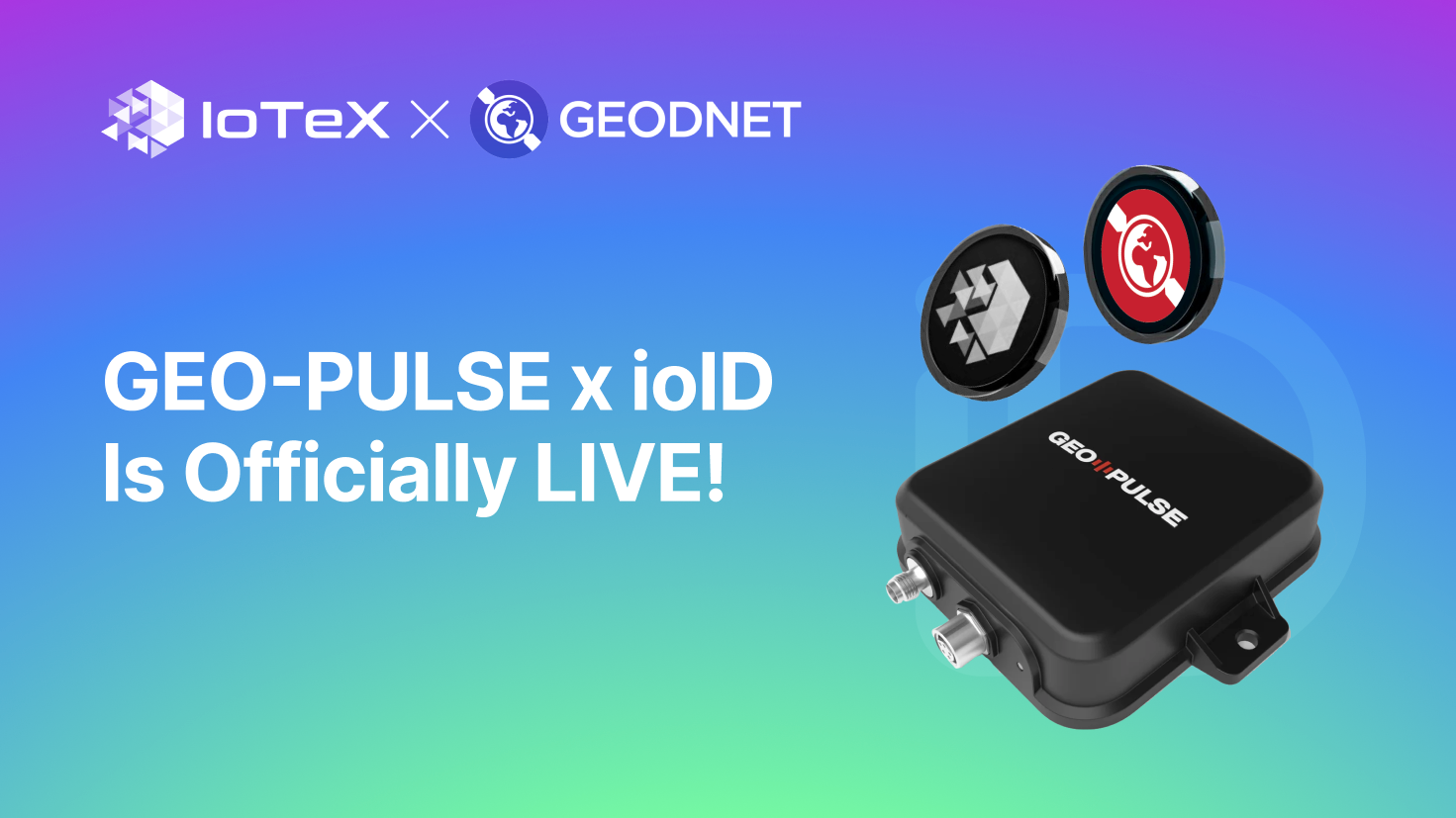
IoTeX and GEODNET's Collaboration for GEO-PULSE x ioID
IoTeX and GEODNET's Collaboration for GEO-PULSE x ioID
IoTeX and GEODNET have launched a groundbreaking collaboration for GEO-PULSE x ioID, marking a significant milestone in the blockchain industry. The integration of ioID and W3bstream into GEODNET's new GEO-PULSE device brings verifiability to DePIN devices and kickstarts IoTeX's DePIN x AI data pool using real-world data. This collaboration sets a new standard for DePIN verifiability, offering users the opportunity to earn rewards in $GEOD and $IOTX tokens by completing quests and verifying location data.
The collaboration has activated the end-to-end tech stack that powers the GEO-PULSE device, which is now being shipped to early adopters. Users can register their devices, complete driving quests, and share location data to earn tokens. The GEO-PULSE device, known for its high-precision lane-level positioning, collects valuable real-world information verified through IoTeX's technology stack, including ioID and W3bstream.
Signup for latest DePIN news and updates